


Points of Interest Along the Greenbrier River Trail
Once a C&O rail line, the Greenbrier River Trail follows 78 miles of the longest free-flowing river in the East and winds through two counties rife with wildlife and scenic beauty.

Once a C&O rail line, the Greenbrier River Trail follows 78 miles of the longest free-flowing river in the East and winds through two counties rife with wildlife and scenic beauty.
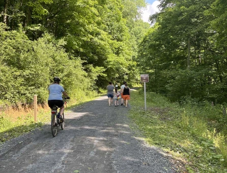
Following the Greenbrier River from Caldwell, WV to Cass, the trail’s mellow one percent grade and numerous access points make it accessible to hikers and bikers of all abilities.
A wide gravel-packed path, white “whistle post” mile markers, park benches and water stops are all trademarks of the trail. Plan a long weekend with bed-and-breakfast or camping stops for an excellent, if ambitious, introduction to the trail’s entirety. Two tunnels, dozens of bridges, spectacular views -- including waterfalls, rhododendron, sweeping vistas -- and yes, the river, entice many to follow this scenic “byway” through the mountains.
Bridges along the Greenbrier River Trail are being redecked. The project is expected to take two years, beginning January 25, 2026 at the southern end of the Trail, near Caldwell. Be aware that as repairs are made, certain sections of the trail will be closed to through travel.
July 6, 2026 Notice. The trail section between Buckeye (MM52.18) and Stillwell Park (MM55.06) will close on July 8 for the bridge re-decking project. The section between Buckeye (MM52.18) and Seebert (MM45.77) will reopen, but please note that the Buckeye to Seebert section will close again in the near future to complete the bridge.
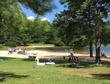
The most southern section, the 33 miles in Greenbrier County, delivers laid-back hiking, biking, fishing and the consummate swimming hole or two. The trail begins a few miles from Lewisburg. Within the first mile, a picnic area complete with creek and waterfall will entertain even the youngest of family members. Another half mile, mile marker 4.3, the river routes around a flat-topped boulder. A regular hangout for sunbathing and a refreshing dip, there are steps and and a handrail leading to the river.

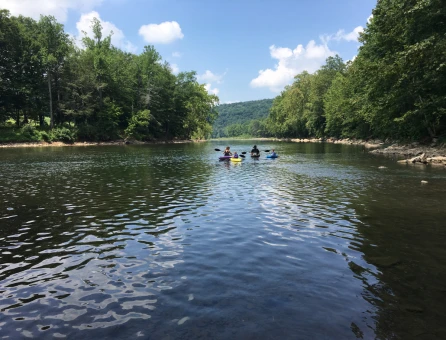
One mile south of Anthony at mile marker 13-14, there is easy access to a wide, deep pool on the Greenbrier River, perfect for swimming and fishing. For those who prefer to be on the move, bring an inner tube for a leisurely cruise on one of the nearby sections. A scenic side trail during the summer months, hop off at Anthony Creek. Take the bridge over to river left—you’ll see the trail on your right. It winds into the mountains with creek crossings and deep pools for swimming.
Safety note: This is a wild river. If you’re planning on getting wet, wear a PFD. And never, ever dive head first. There are rocks in these parts.
One of the most unexpected encounters along the trail is The Greenbrier Goat at mile marker 22.5—a hiking/biking adventure led by Aaron and his three pack goats, Ragnar, Floki, and Athelstan. These American Alpine brothers are trained to carry up to 50 pounds each, making them ideal companions for one-day or multi-day hikes along the Greenbrier River Trail.
Headed up the trail? Book the Cowboy Breakfast. Whether you're arriving on foot or by bike, this mid-trail meetup offers hearty camp fare made from local ingredients, along with wildlife spotting opportunities and time to hang out with the goats. It’s part trail break, part backcountry hospitality... just be sure to reserve in advance.

Just North of Renick at mile marker 25 and a mile off the trail, White Oak Blueberry Farm and the Friendly Goat Fruit Farm offer a tasty, seasonal detour where you can pick sun-ripened berries by the bucketful. This family-run farm is a favorite summer stop for trail users craving the region's sweet treats!
About 400 feet long and built in 1900, the tunnel at mile marker 30 cuts through the mountain near Horrock. At its darkest point, it’s easy to feel a moment’s hesitation before seeing light from the tunnel opening on the other side. With little development or private land in this area, the section above the tunnel (mile 31) at Beard is considered one of the most scenic. Rapids and remote trailside campsites are ideal for overnight or full-day excursions. Bring a fishing pole. The smallmouth and rock bass are known to thrive in these waters.
The Droop Mountain battle was one of the last major engagements of the Civil War in West Virginia.
With shuttle services and rentals for both water and land, local outfitters can help make the most out of your experience on the Greenbrier River Trail.
Greenbrier Outfitters - bike, kayak and SUP rentals and guided trips
Hammer Cycles - shuttle services, bike rentals, including e-bikes
River City Bikes & River Adventures - bike, e-bike and watercraft rentals with/ equipment delivery and transportation services
WV Outdoor Adventures - shuttle services
Free Spirit Adventures - bike rentals, shuttles and tours

Backpacker Magazine rated the Greenbrier River Trail one of the top 10 hiking trails in the U.S. They’re spot on!
The trail is open to hiking and backpacking, biking (including Class 1 and 2 electric bikes), and horseback riding. Dogs are welcome but must be leashed. The trail is also popular for birdwatching, fishing and swimming access, and winter activities, such as cross-country skiing and snowshoeing, when conditions permit.
The trail is 78 miles long, starting at Cass Scenic State Park in Pocahontas County and descending to Caldwell in Greenbrier County. Overall, the trail’s elevation gain is 992 feet, making it a mild trek in either direction.
At 78 miles, adventurists regularly explore the trail in sections, so there are numerous access points to get on and off the trail. Some locations have more space for parking than others, so be sure to review the access points and corresponding mileage to determine what works best for you. Here are the access points/mile markers (MM) in Greenbrier County: MM 3.1, MM 3.5, MM 5.7, MM 11, MM 14.2, MM 21.5, MM 24.9.
Yes, all trailheads along the Greenbrier River Trail include parking. Some offer more plentiful parking and other amenities. Here are the primary access points in Greenbrier County.
MM 3.1 Caldwell Trailhead/Stonehouse Rd. includes horse trailer parking, bicycle repair station, picnic table and water (water is turned off in the winter)
MM 3.5 Caldwell Trailhead/Camp Alleghany Rd. includes horse trailer parking, a bicycle repair station and a sheltered picnic table
MM 5.7 Hopper trailhead/Harper Rd. offers limited parking but includes a handicap-accessible pad and a sidewalk leading to the trail.
MM 14.2 Anthony Rd. offers horse trailer parking and river access, a tenth of a mile east at the Anthony boat launch.
MM 24.9 Renick/Auto Rd. includes horse trailer parking, bicycle repair station and river access.
Yes, camping is permitted at designated sites along the trail, of which there are fifteen. Most are equipped with a picnic table, fire ring, toilet and tent pad(s). Some offer additional amenities such as an Adirondack-style camping shelter, bathroom and drinking water.
These campsites are free to use, but arrive early during peak season since they cannot be reserved. And always have a backup plan.
Want to get connected? Sign up to receive our monthly GBV Insider’s Guide enews, packed with seasonal trip ideas. For a closer look at what’s going on, opt into our Weekly Calendar of Events enews—it’s a 7-day snapshot of the week ahead.